The past seven days in Iceland have stretched our imaginations beyond our wildest dreams! From lava fields of volcanic craters, ancient glaciers, and geothermal hot springs to picturesque fishing villages, magnificent waterfalls, black sand beaches and ice caves, this “land of ice and fire” truly seems to have it all!

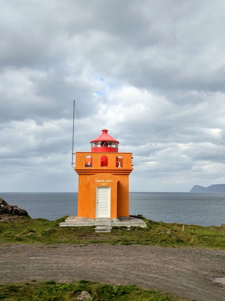
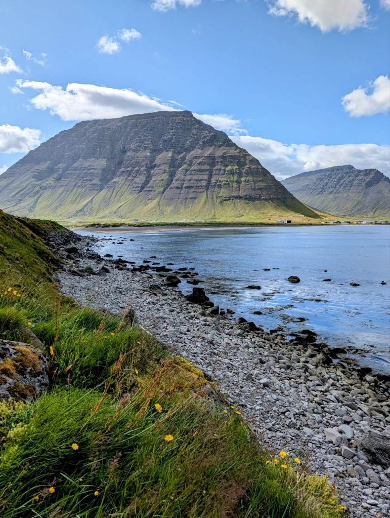
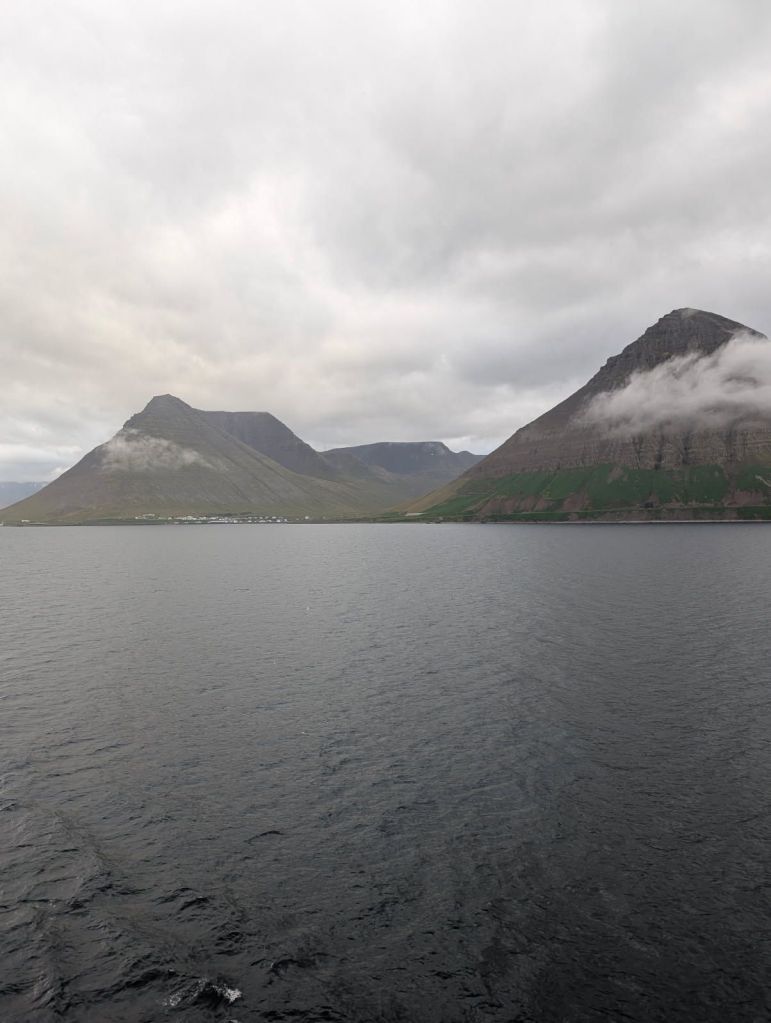
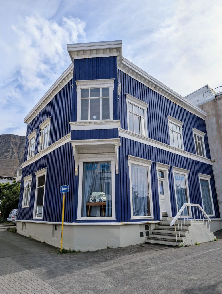
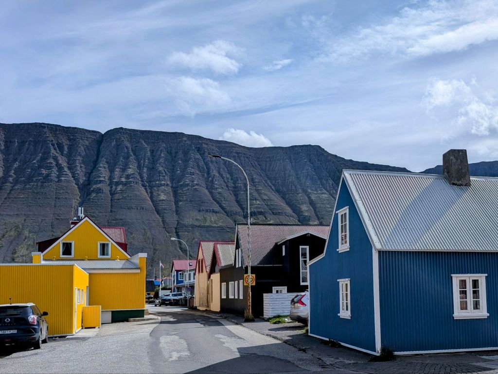
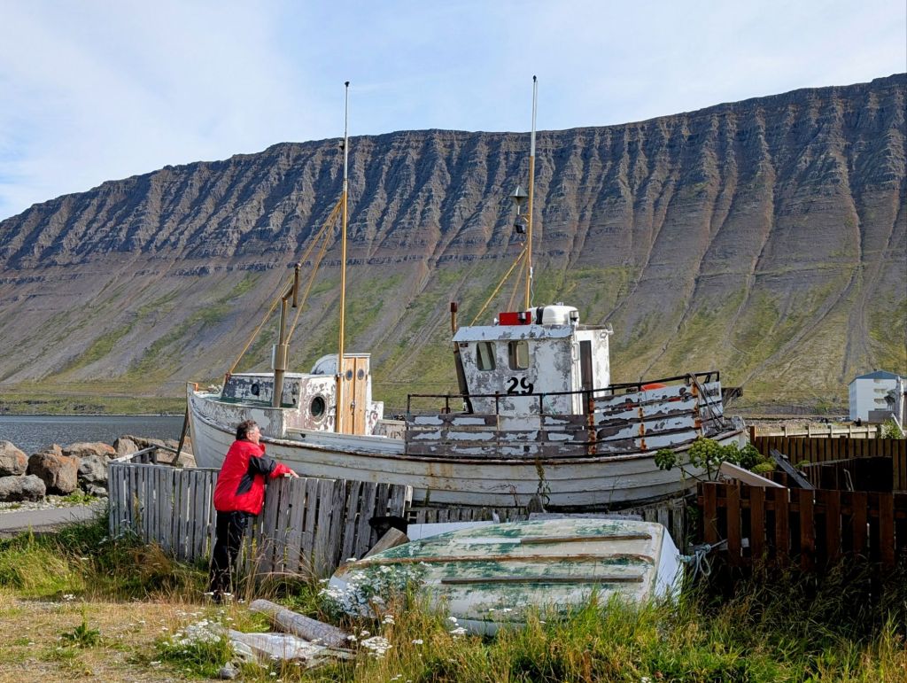
Our first day in Iceland was spent in and around Isafjordur (Icy Fjords), the largest town in the Westfjords Region of northwest Iceland. Nestled at the foot of dramatic mountain slopes, this area has become a gateway for exploring some of Iceland’s most majestic natural splendor. The old town has wooden houses built by fishing merchants in the 18th and 19th centuries. The surrounding area tells tales of the evolution of the fishing industry, the region’s largest employer.
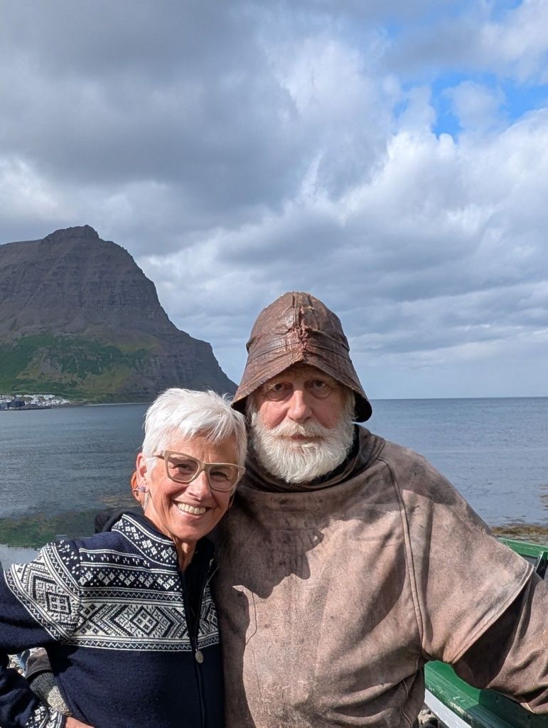
Bolungarvic is a tiny fishing village on the outskirts of Isafjordur Bay. There we met up with Johan, a fisherman in full sheepskin garb. The skins are treated with cod liver oil to provide some waterproofing and flexibility and the under layer and gloves are made from sheep’s wool knitted by his wife.
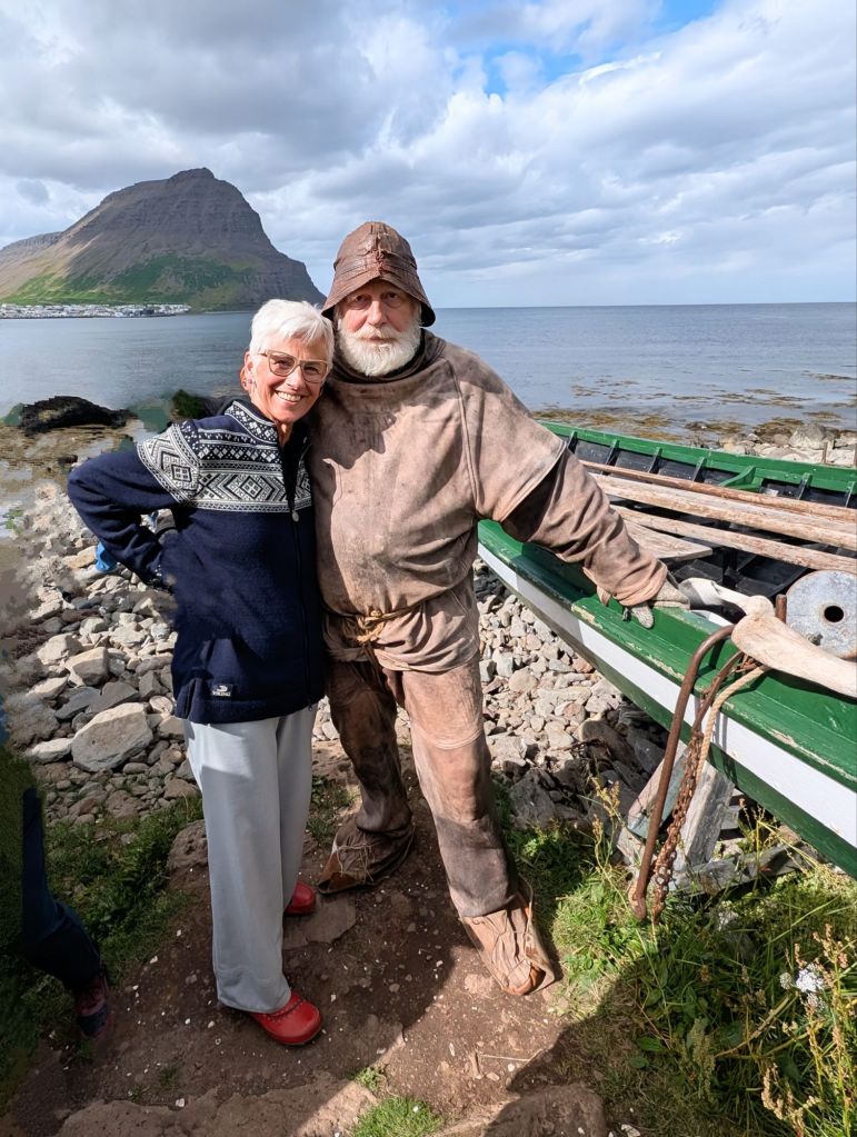


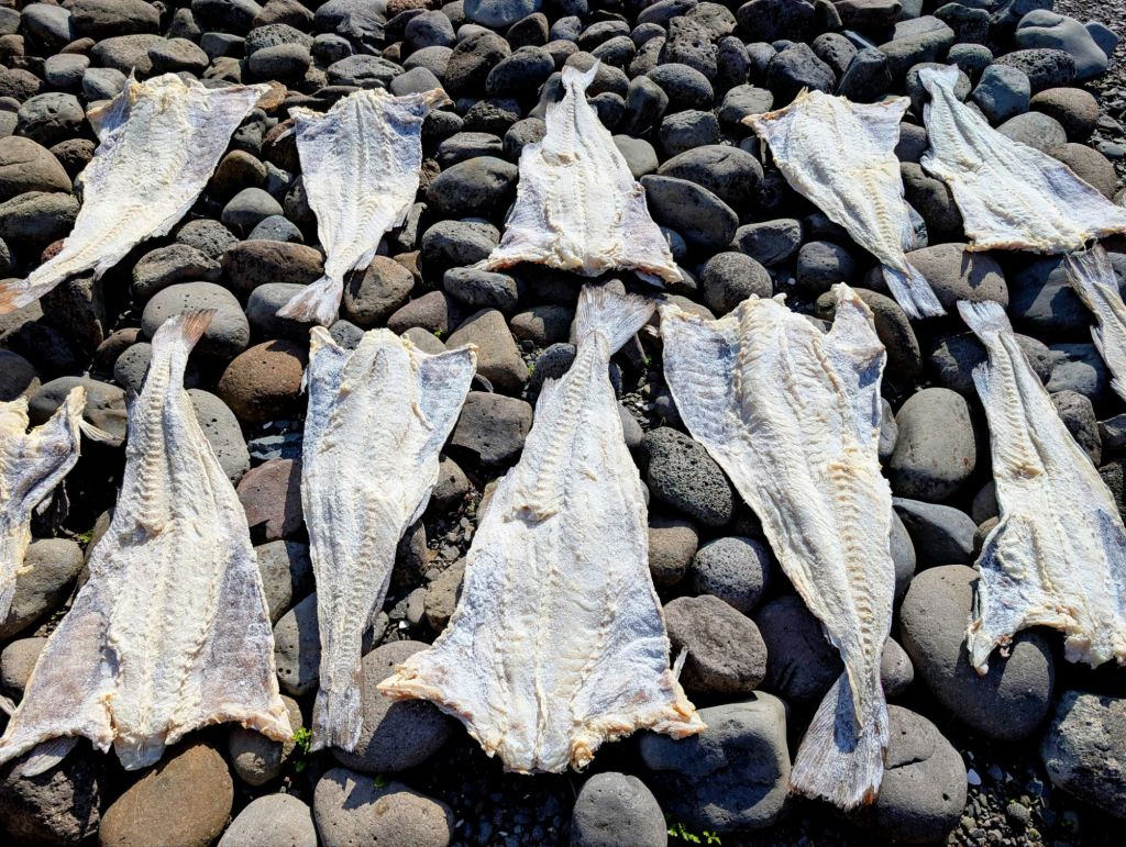
Johan, with the aid of an interpreter, described early fishing life in the area. Six men would head out in a boat like this and if they were very lucky they’d land a shark. The shark’s liver was extremely valuable for the oil that, once extracted and purified, was exported throughout Europe for light. Cod would be dried and sold for food.
The Museum of Osvor is a reconstructed fishing station. There we learned more about the early days of the Icelandic fishing industry. There is a fisherman’s hut, tools of the trade, a salting house, and a drying rack as well as various remnants of fishing days gone by.


We also caught a glimpse of our first Iceland waterfall, with many more to come.


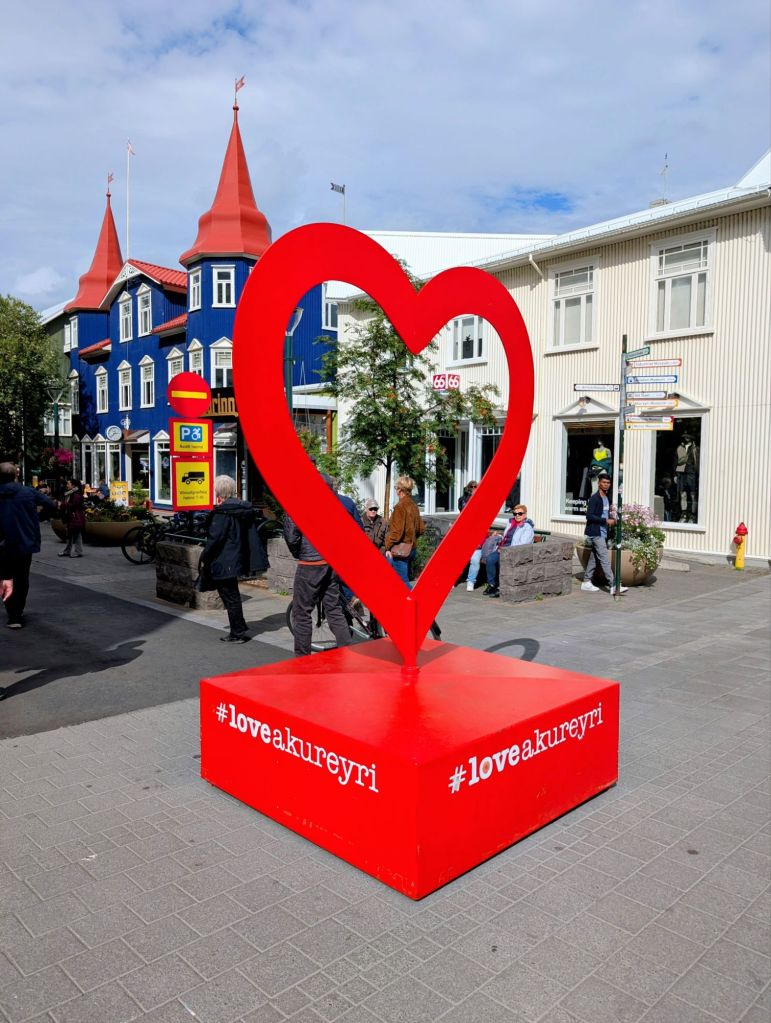
Our second day in Iceland took us through some beautiful scenery to Akureyri, also known as the “Capital of the North.” Nestled at the end of the Eyjafjordur fjord and at the foot of towering mountains, Akureyri enjoys a mild climate, unusual for a northern city just 62 miles from the Arctic Circle. These moderate temperatures have contributed to Akureyri’s growth as an agricultural center and as an ice-free port.
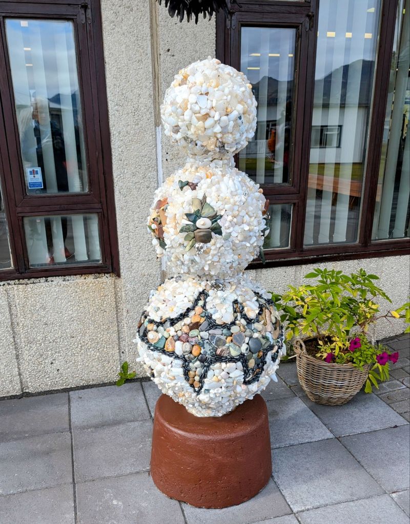
Akureyri is a charming town of roughly 20,000 people. Its public park and botanical gardens attract visitors from near and far. Red hearts have adorned stop lights since 2008. During the financial meltdown that year, the mayor added the hearts to remind folks what really mattered and to give them something to smile about. Since then, other whimsical hearts have popped up around town.

Towering over the town is the hilltop Akureyrarkirkja, a Lutheran church designed by Gudjon Samuelson who designed Reykjavik’s famous Hallgrimskirkja. One of the stained glass windows was moved from Coventry Cathedral in England to Akureyri during WW II and has never been returned.


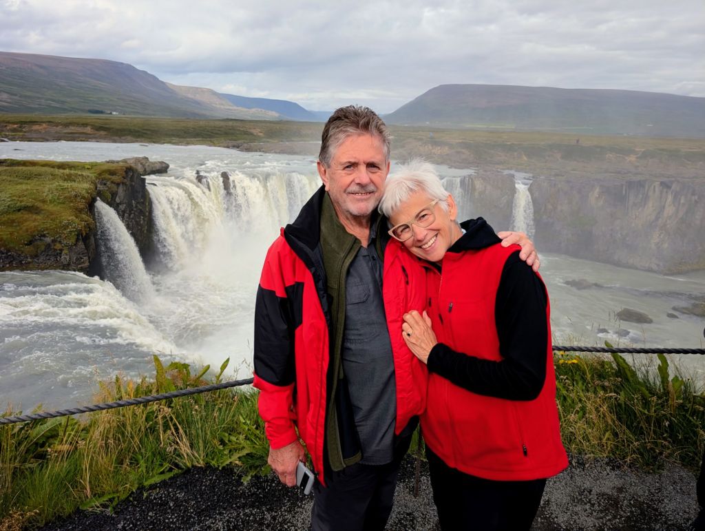
A short drive through the beautiful countryside took us to the famous horseshoe-shaped Godafoss Waterfall. Also known as the “Waterfall of the Gods,” it is known for its beauty and historical significance. According to legend, Icelandic chieftains made the decision to convert the country to Christianity in the year 1000 AD. After that, they are said to have thrown their statues of Norse gods into the waterfall. Some say the gods assert their powers from time to time in various ways associated with powerful water-related events. The waterfall can be approached from both sides offering different views and vantage points from above and below, all spectacular!


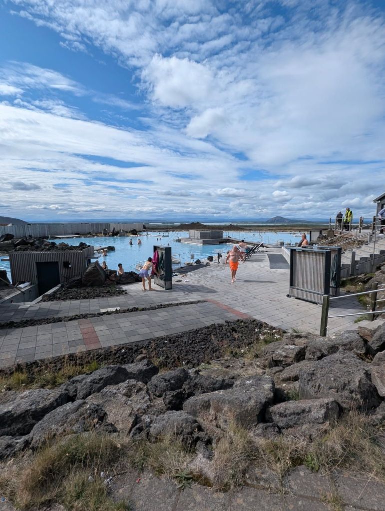
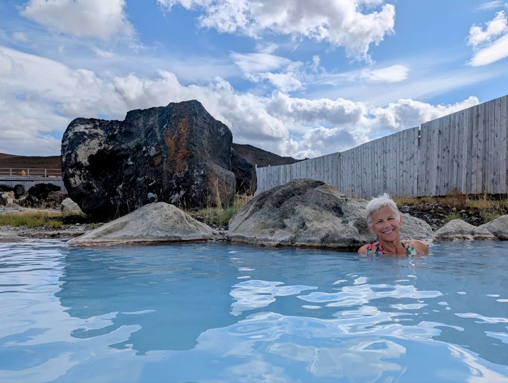
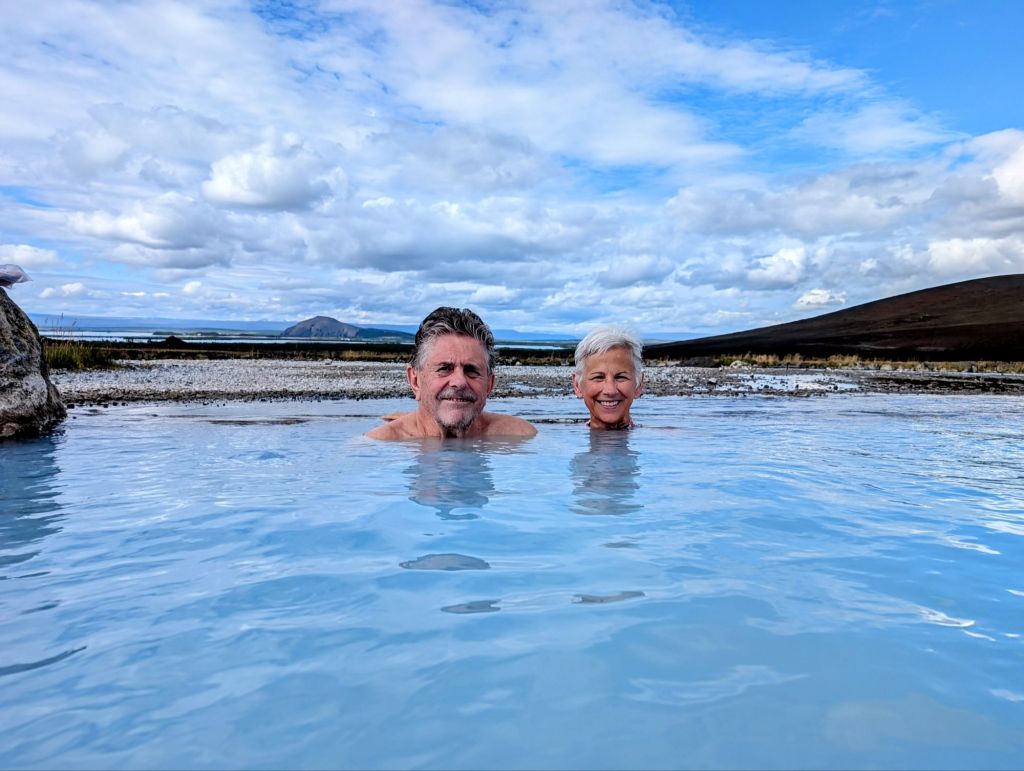
After an exhilarating visit to the falls, we continued through the beautiful countryside where we saw flocks of grazing sheep, interesting lava formations, and the occasional Icelandic horse to the Myvatn Nature Baths. This popular and relaxing geothermal pool is often referred to as the ” Blue Lagoon of the North.” Located in the Lake Myvatn area known for its unique geology and geothermal activity, the baths offer a tranquil and scenic experience in naturally heated, mineral-rich pools.

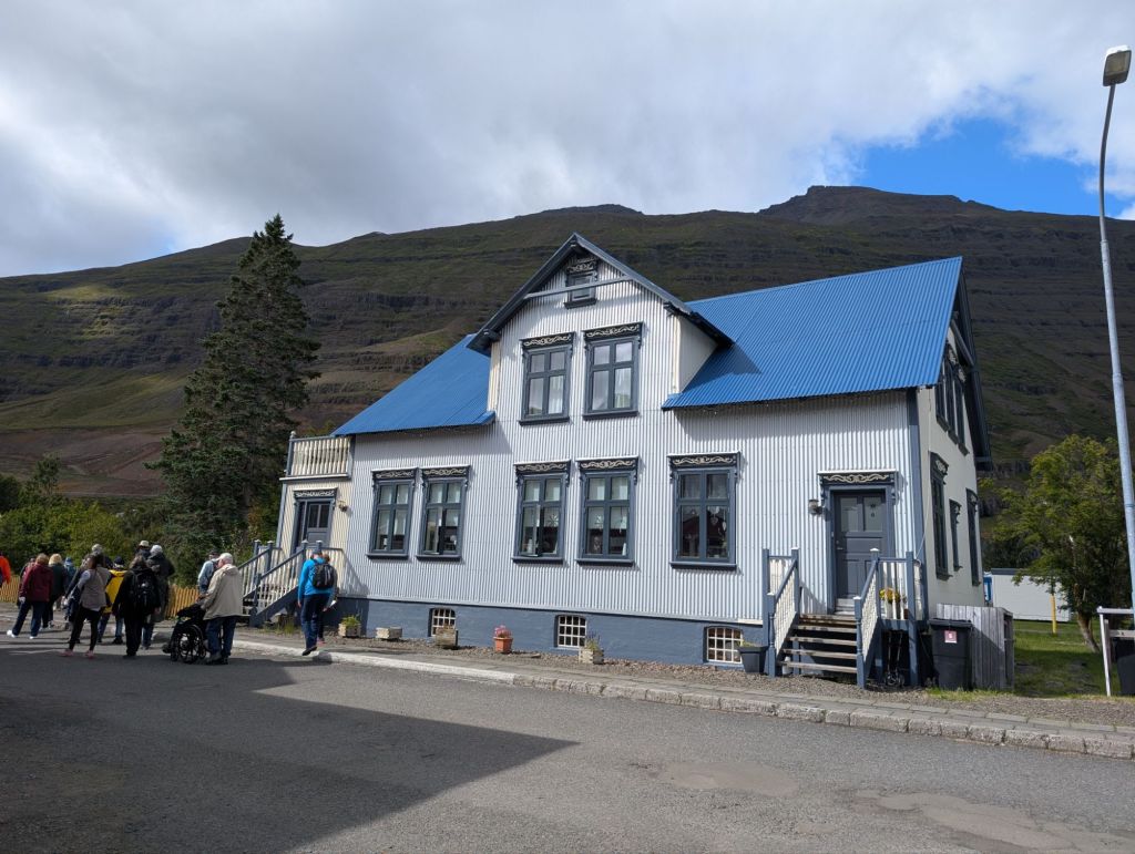
Our third day in Iceland was spent in Seydisfjordur, a tiny town with an impressive but eclectic history. The small town of 700 is situated at the end of one of Iceland’s most beautiful fjords between two mountains.


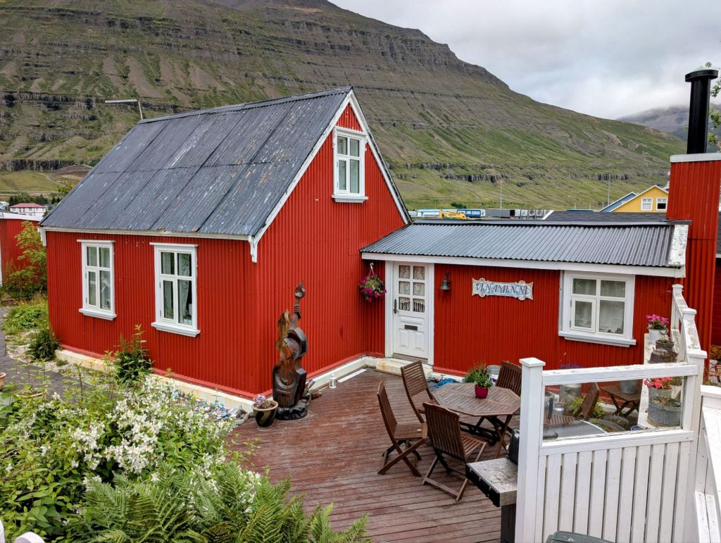
Norwegian fishermen and merchants settled the town in 1848, bringing much of their culture and traditions with them. Heretofore, the native Icelanders had been living in modest sod houses and working primarily as local fishermen. The Norwegians ordered kits from back home to build wooden houses, some of which still stand today. They also built a robust herring trade industry which helped to improve the area’s overall quality of life. As a Danish colony and having no military, Iceland was neutral during WWII. However, due to its location and other strategic advantages, British troops came to the area in 1941 in an effort to protect it from Germany. Living in tents, the British found life in northern Iceland unbearable. The following year, US troops replaced the British soldiers and and built barracks to sustain themselves during the harsh winters. This presence brought about significant economic and employment opportunity in helping to build military infrastructure and supplying goods and services. It also led to the introduction of many western technologies and ideas. And the social interaction with Allied soldiers gave birth to to a temporary population boom that some Icelanders refer to as “the situation.” Life in Seydisfjordur was forever changed by the presence of the US troops. It embraced a lot of the new technology and customs, but held fast to their own traditions as well.
Today many of the colorful wooden homes built by the Norwegians line the town’s streets under the picturesque slopes and soaring summits of Mounts Bjolfur and Strandartindur.


The blue church at the center of town provides a welcoming space for worship, meetings and other types of gatherings where all are welcome. A brightly painted rainbow road leads through the heart of town to the church.


The mountains that flank the town are said to have magical powers due to the presence of crystals within. One has only to make a wish and it will come true! A gentle waterfall runs from top to bottom.


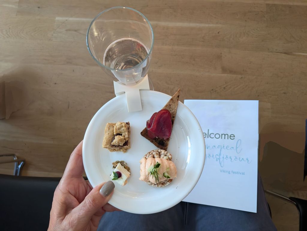
Art, music and gracious hospitality are very much a part of life in Seydisfjordur. We were fortunate to be treated to an afternoon Viking Festival at the town’s contemporary Community Center. We listened to traditional music by vocalist Bjort Sigfinnsdottir accompanied by guitarist Jon Hilmar Karason while enjoying some delicious food and drinks.

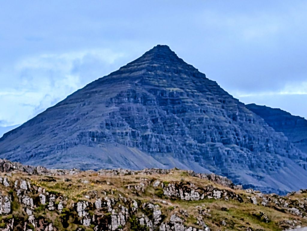
As we made our way from west to east, our fourth Icelandic port of call was the small, tranquil town of Djupivogur on the Berufjordur Fjord. A fishing and trading center since the 16th century, the town sits in the shadow of the towering pyramidal Bulandstindur Mountain. This is yet another Icelandic “magic mountain,” especially powerful for granting wishes during the summer solstice. Locals tell tales of the trolls and gnomes who inhabit the mountains, including the legend of Iceland’s 13 santas!
The 500+ Djupivogur residents formally adopted the cultural trend known as “Cittaslow” in 2003. Cittaslow is an international movement that promotes slow living as a way to achieve personal and environmental health. They believe that a city is defined not only by its architecture, but also by its relationships, its food, its nature and its soundscape. They promote local food, arts and crafts, and work hard to preserve the region’s unique cultural heritage.

Several old buildings have been carefully preserved to honor the past. Langabud (1740) is the town’s oldest and today houses a cafe, cultural center and gift shop. Faktorshus (1848) is home to a local brewery.

“Freedom” is a memorial sculpture honoring the life of Hans Jonathan. A native of St. Croix, Hans was sent to Copenhagen at age 7 to become a slave. He served a rich family and later courageously defended Denmark in the Battle of Copenhagen in 1801. He was denied freedom despite his heroic war efforts, so he literally broke free and fled to Iceland. There he was embraced by the people of Djupivogur as its first black resident. He married a local girl, raised a family and became a successful trader and prominent member of the community. Genealogists have traced over 800 locals with ties to Hans.

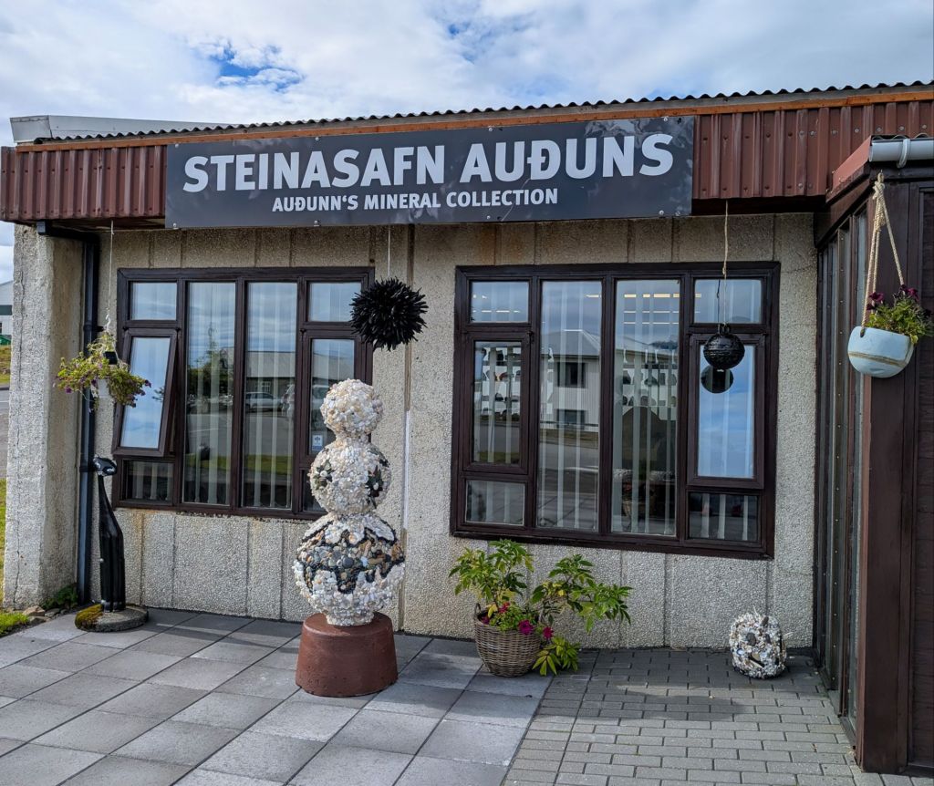
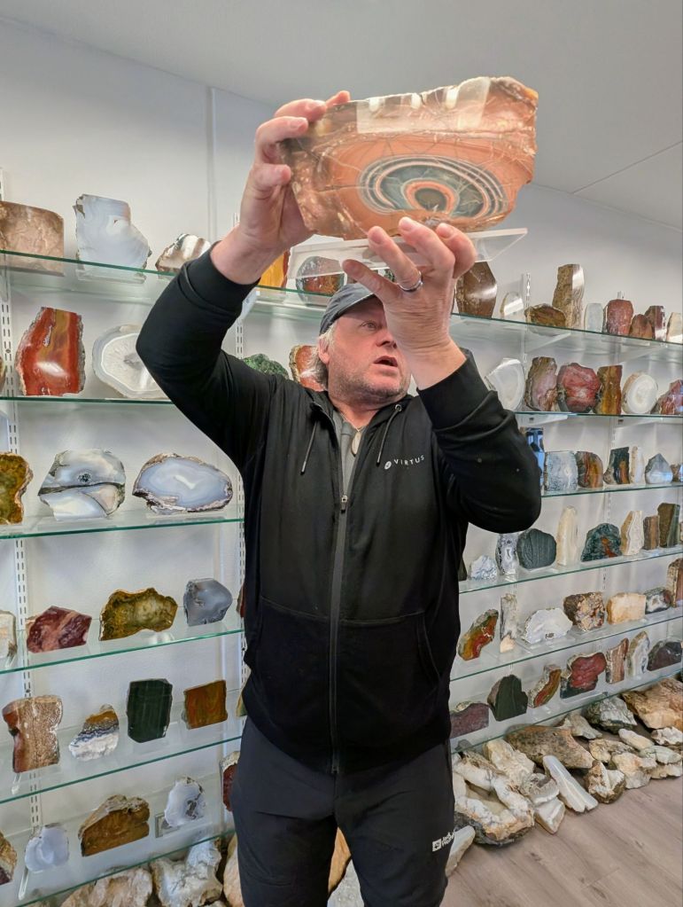
The mountains surrounding Djupivogur are full of hidden gems, minerals and crystals. Local collector Steinasafn Auduns has found literally thousands of beautiful stones and has uncovered the beauty within. He displays them in a small shop that feels more like a museum.


What do you do with a huge barrel that was used to hold cod liver oil? You make a performing arts center! The acoustics are perfect, and the sound is haunting and beautiful.


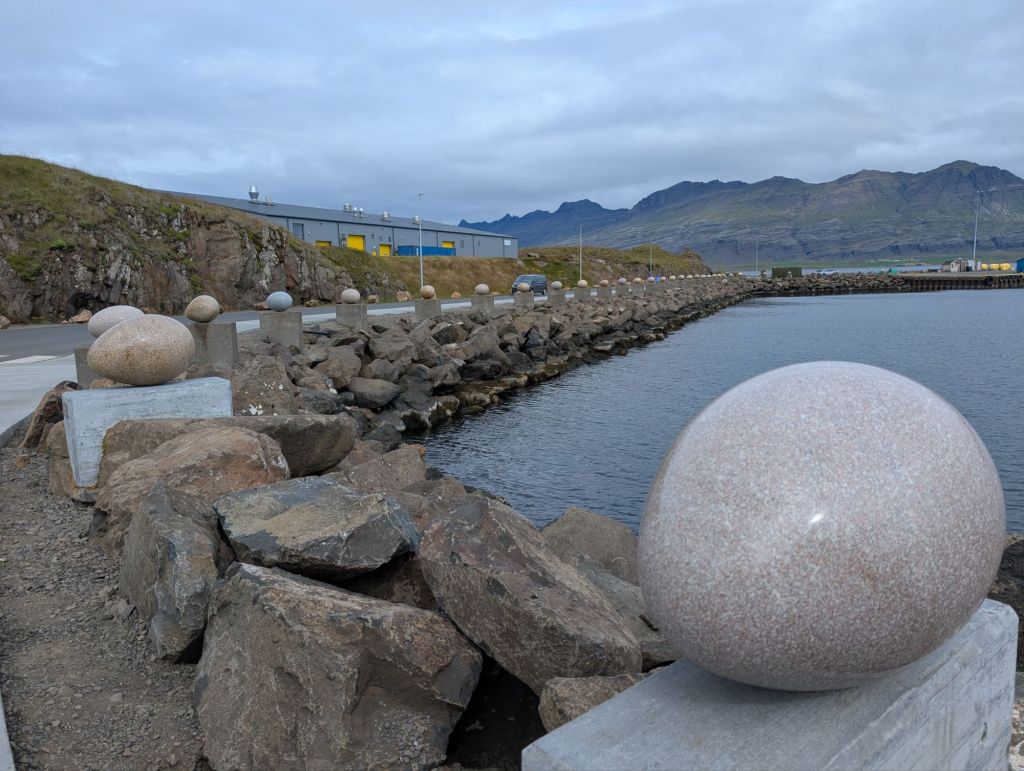
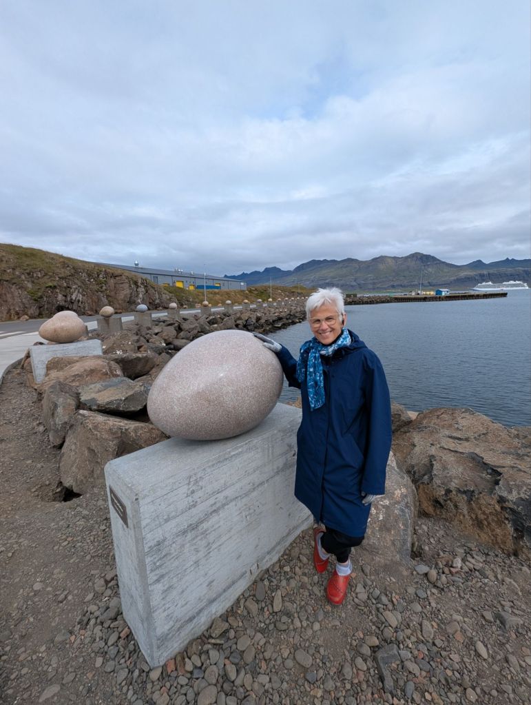
Another popular attraction is Eggin in Glesivik (Eggs in Merry Bay) by artist Sigurdur Gudmundsson. The 34 Chinese granite sculptured eggs perfectly capture the various bird species across the region.

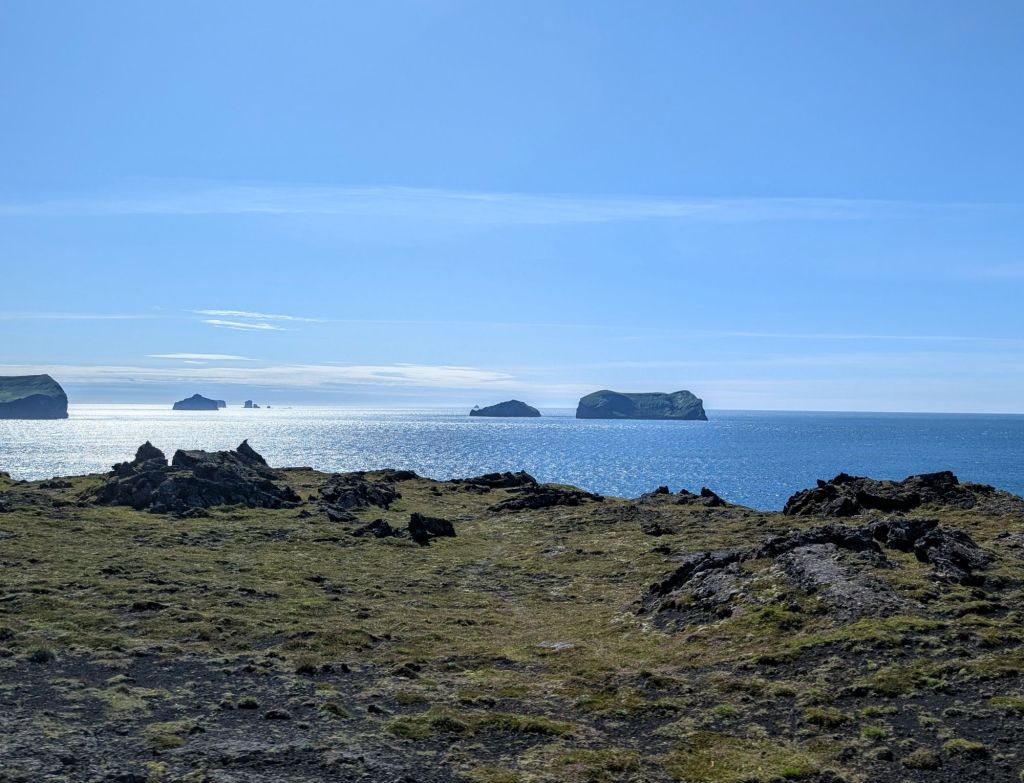
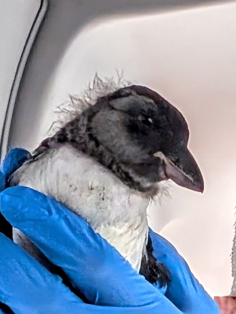
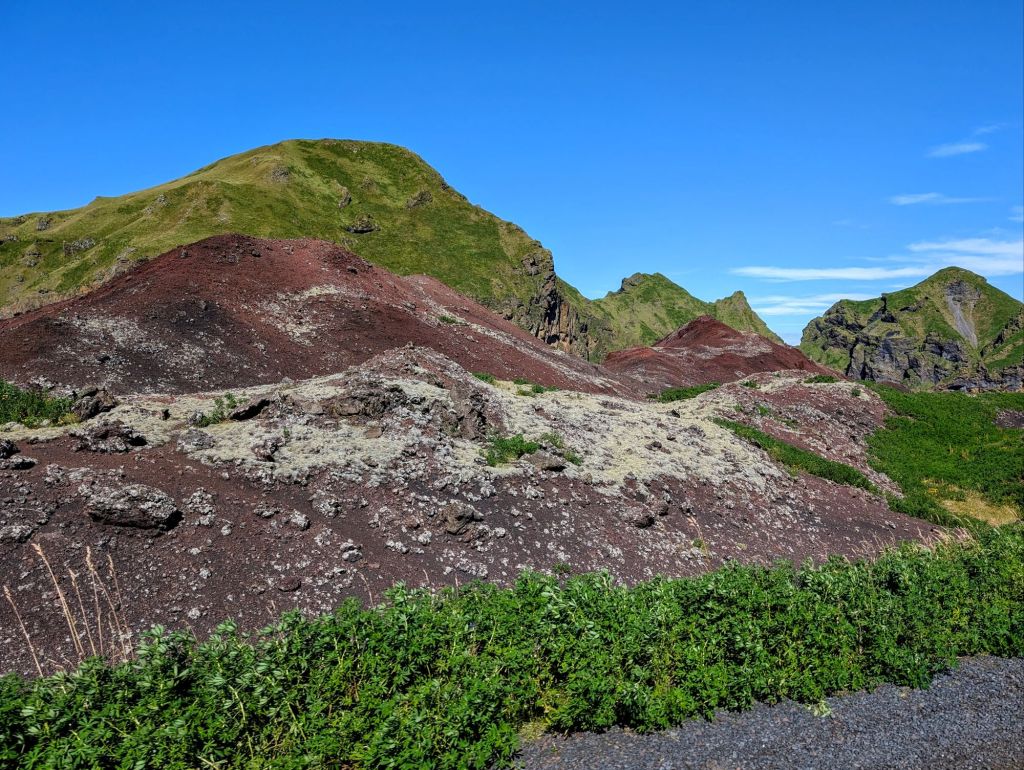
Our fifth Icelandic port was the island of Heimaey, the only populated island in southwest Iceland’s Westman Islands. The island’s moss-covered sea cliffs, rare and abundant bird life (more puffins than people!) and expansive volcanic landscapes make Heimaey a stunning destination.

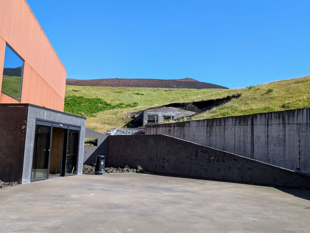
In 1973, a sudden eruption of the Eldfell volcano ripped through the center of town and literally reshaped the island. It destroyed 400 homes and forced a total evacuation of its residents. A small number stayed on long enough to pump sea water onto the lava and save the harbor from destruction. Residents could not return for six months…some never did. A touching museum using actual excavated homes and other artifacts has been built to memorialize the event and showcase the resilience of the people who preserved and rebuilt their community.


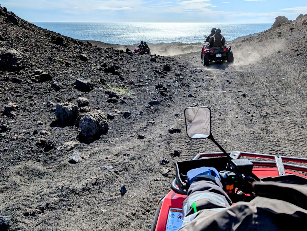
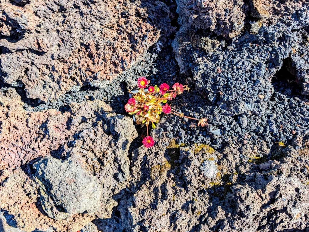
An ATV is an excellent vehicle way to explore the lava fields.


On our sixth day in Iceland, the Neptune docked in Reyjavik. We had heard about the Golden Circle, a 190 mile loop from Reyjavik into the southern uplands and back, so we decided to take it. So happy we did!

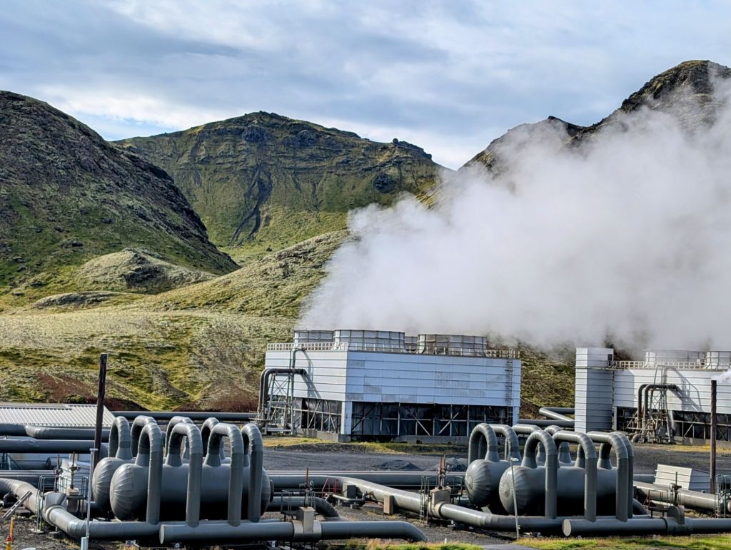
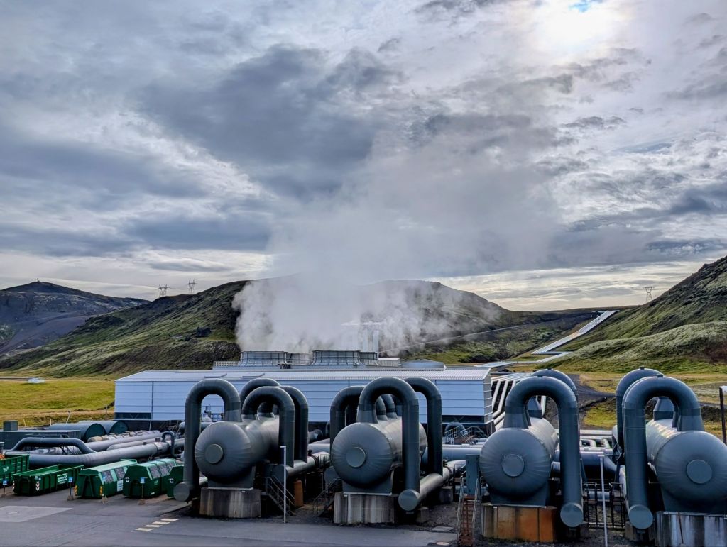
We drove through beautiful countryside deep into the Geyser Geothermal Area where we stopped for an impressive tour of the Jarohitasyning Geothermal Exhibition.

The exhibition is interactive and uses multimedia technology to describe the geothermal production process; the rich history of geothermal energy research and development in Iceland; steam turbines at work; an overview of the power plant; and the Carbfix method of turning carbon dioxide into stone. With 90% of its homes using geothermal heat and 30% of its total electricity production generated by geothermal energy, Iceland is truly a world leader in the sustainability movement.
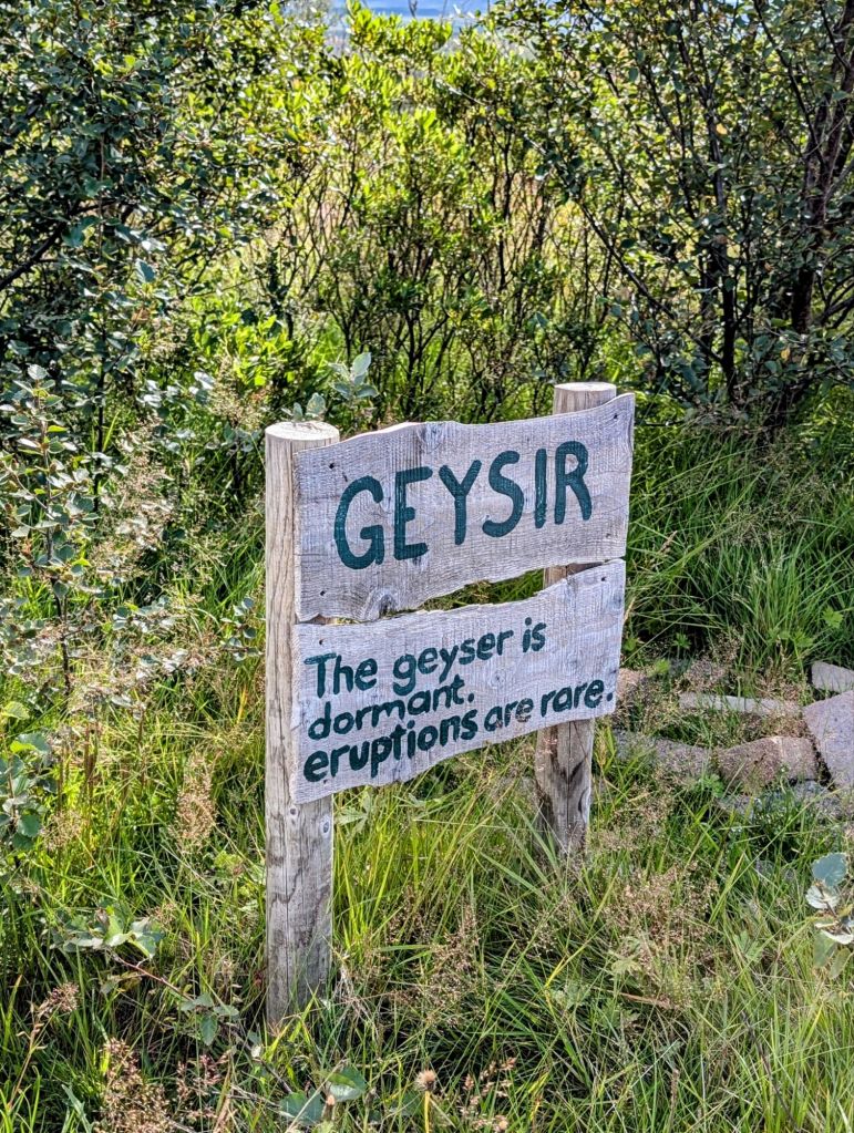
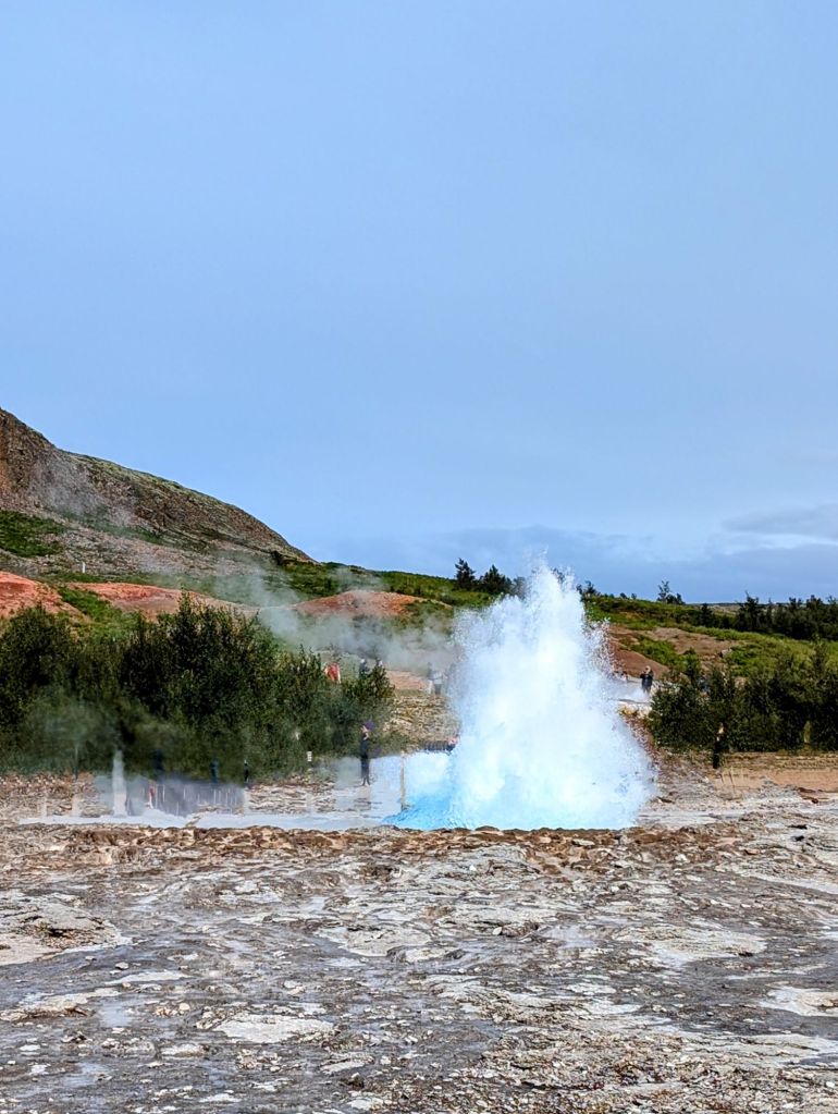
A short drive took us to the Strokkur Geyser and other hot springs and mud pools.


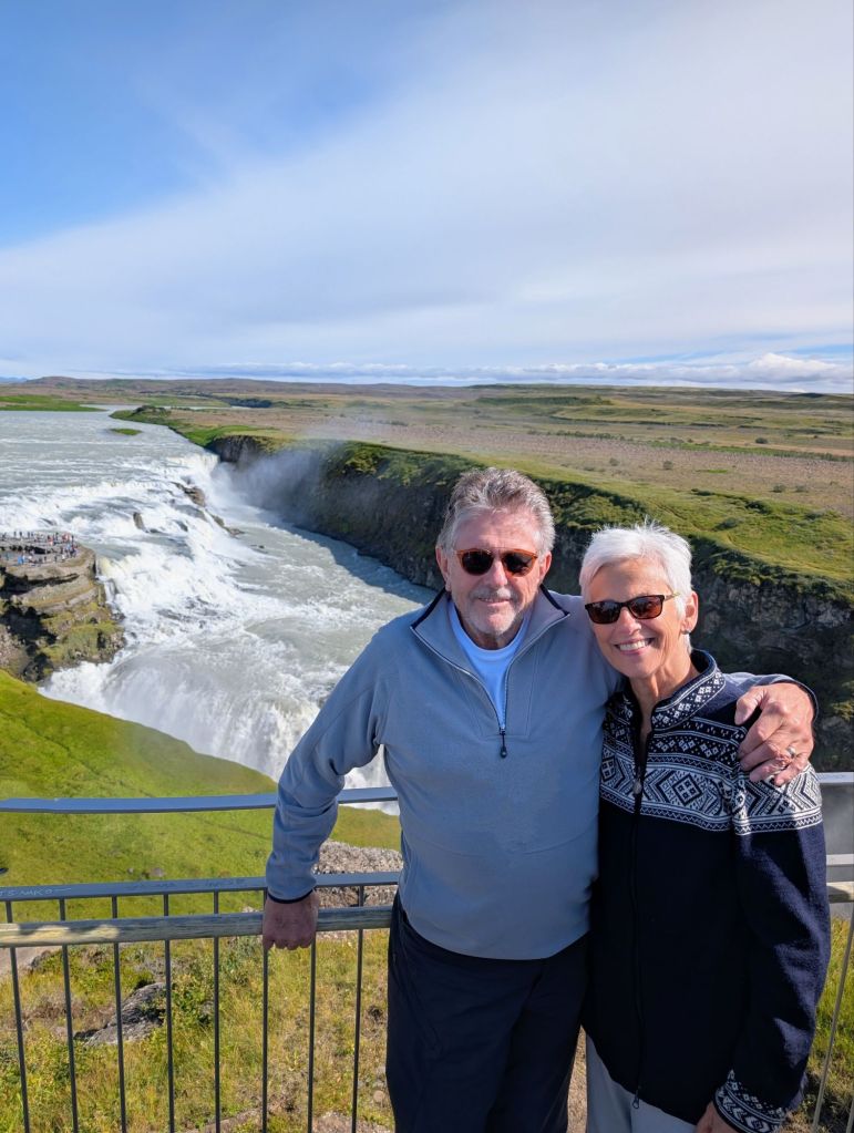
Continuing on our journey, we came to Gulfoss, a powerful, multi-tiered waterfall known for its golden-brown color that shines brightly under the winter midnight sun.

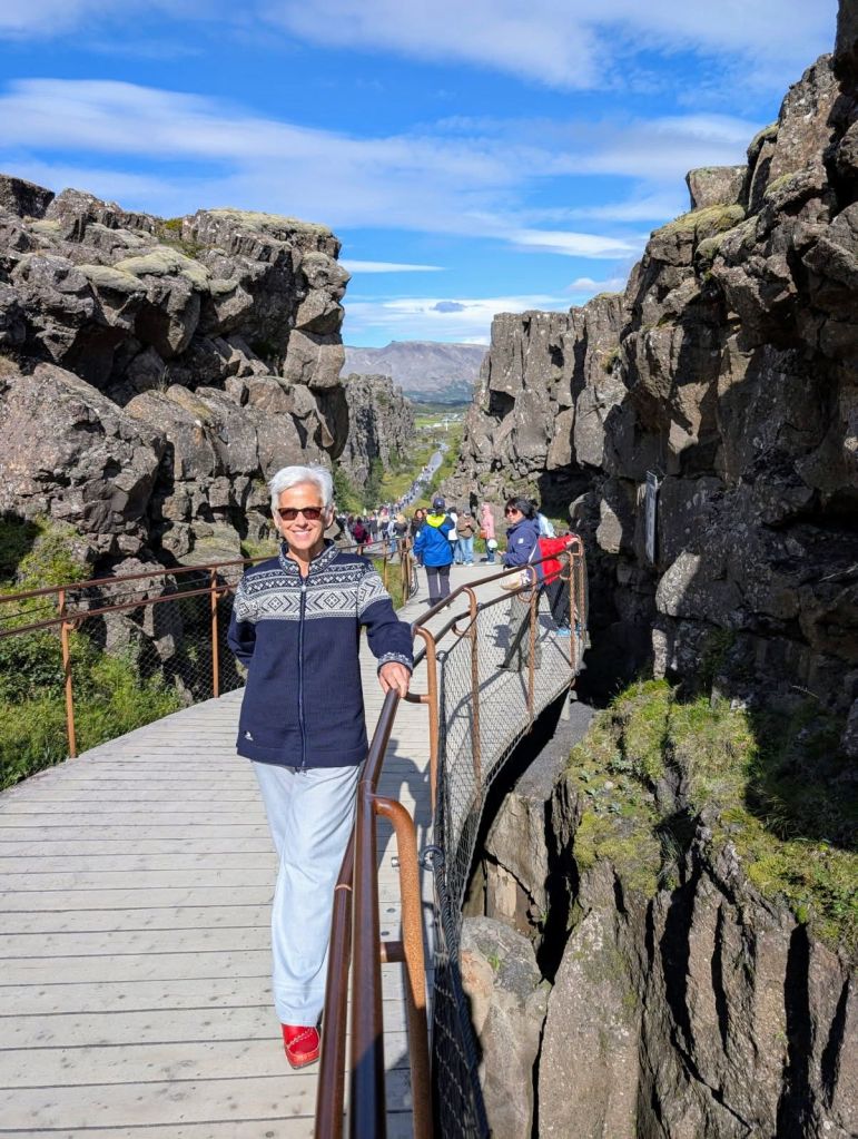
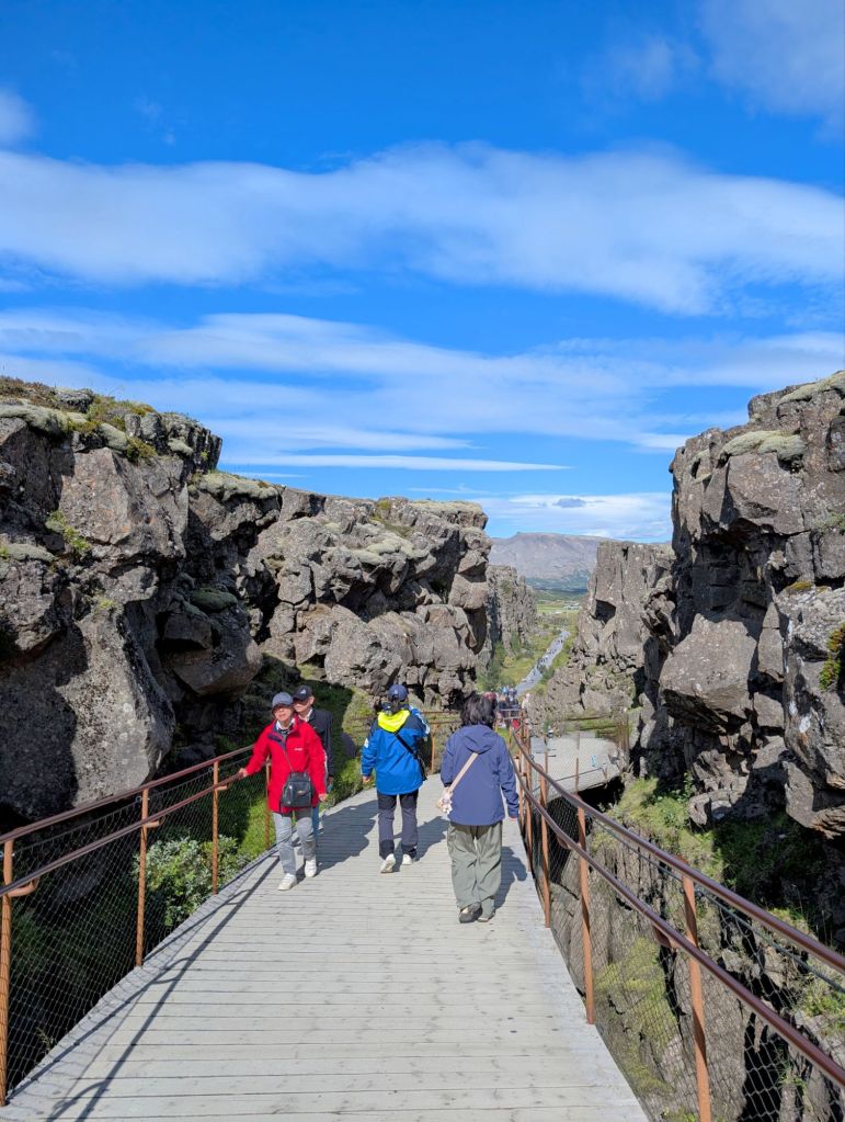
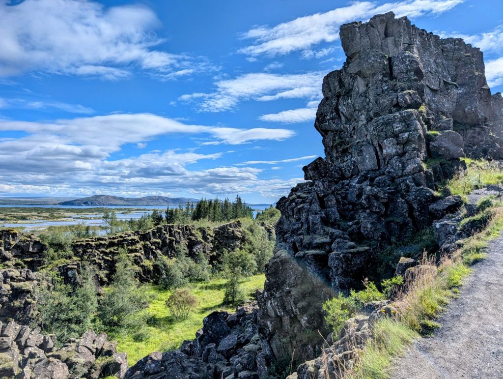
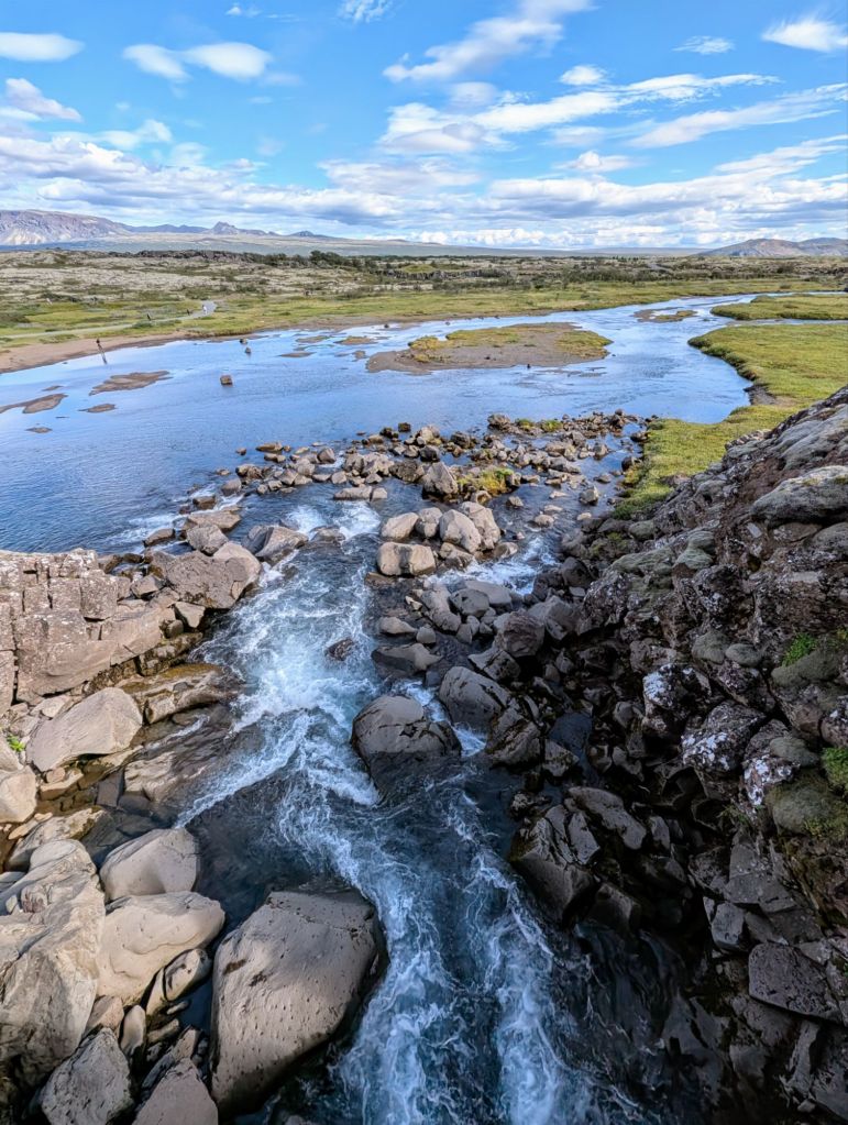
The last stop on our day trip was Pingvellir National Park, a UNESCO World Heritage Site where the North American and Eurasian tectonic plates meet. A leisurely stroll in the gorge between the two provided some breathtaking sites and an awesome sense of being in a very special place.


Although we didn’t get to see much of Reyjavik, we believe we made the right choice for our one day stay. The Golden Circle gave us some beautiful memories and a feeling that we’ll just have to return to experience the city of Reyjavik.
Our seventh and final Icelandic stop brought us full circle back to the charming town of Isafjordur. Having fully circumnavigated all of Iceland, we opted for a leisurely day on our own.

We wandered around this lovely town, taking in its quiet vibe and colorful timber-frame homes and commercial buildings.


Today Isafjordur continues its long history as a fishing town, with remnants of the occupation displayed in museums as well as along the shore


Reflecting on our week in Iceland, we are left with some wonderful memories of its people, places and warmth. We saw a lot, but left a lot to be seen. We definitely hope to return!

I truly appreciate your travel journal and incredible photos. Iceland is an important reminder of the extraordinary planet we call home. I would love to see it in person.
LikeLiked by 1 person
Wow! Beautiful pictures! Thanks so much for all the time you put in detailing all the sights! You should write a travel book! Although I guess in these times – a travel blog that is shared around the world! You could make some serious money on this, Denise!! Thank you for sharing your travels! 😍
LikeLiked by 1 person
Beautiful country!!
LikeLiked by 1 person